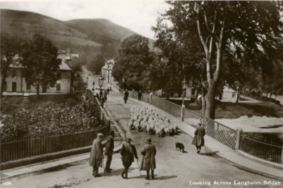
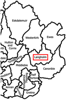
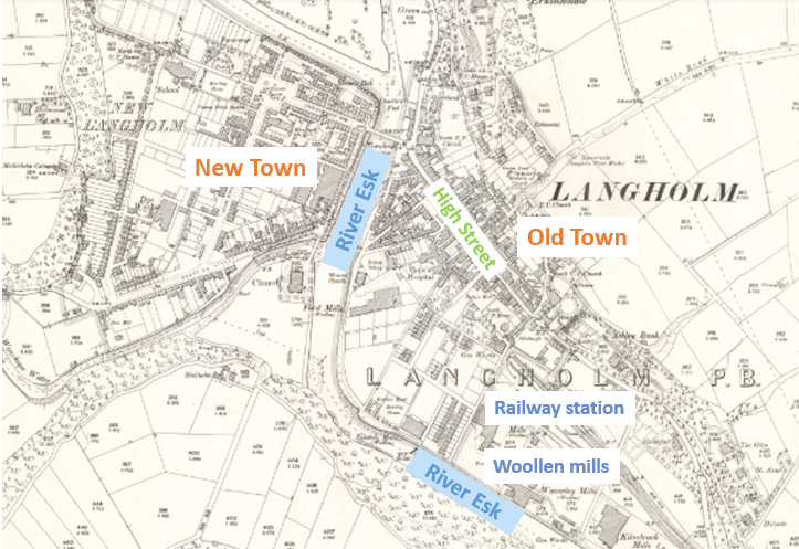
Langholm‘s Old Town grew out of a settlement dating back to the 1400s. Its New Town was developed by major landowner Henry Scott, 3rd Duke of Buccleuch, in the late 1700s. They are separated by the River Esk which flows south to the Solway Firth near Carlisle.
The Esk Valley (or ‘Eskdale’) has produced some remarkable pioneering individuals and organisations in numerous fields:
Pre-1915
| Field | Role | People/Organisation | Connection |
|---|---|---|---|
| Animal breeding | Co-founder of the Labrador Retriever breed | 6th Duke of Buccleuch 1831-1914 | Resident (part-time) |
| Animal breeding | First breeder of emus in Scotland | Richard Bell 1833-1909 | Resident |
| Engineering | First president of the Institution of Civil Engineers | Thomas Telford 1757-1854 | Native |
| Environmental observation | First UK government geomagnetic observatory outside London | Eskdalemuir Observatory 1908-present | Local organisation |
| Faiths | First Sunday School in southern Scotland | Rev John Jardine, North UF Church | Resident |
| Faiths | First Tibetan monastery in the Western world (attended by David Bowie and Leonard Cohen) | Samye Ling Monastery 1967-present | Local organisation |
| History | First western history of Persia using local sources | Sir John Malcolm 1769-1833 | Native |
| Knighthoods | Four brothers with knighthoods: ‘The Four Knights of Eskdale’ | Malcolm brothers: James (Royal Marines officer), John (army major-general, diplomat, historian), Pulteney (admiral, Napoleon’s captor) and Charles (vice-admiral) Eldest born in 1767 – last death in 1851 | Native |
| Legal history | US Supreme Court precedent for charitable trusts | Thomas Hope (entrepreneur) 1809-1890 | Native |
| Libraries | Scotland’s oldest continuing lending library | Westerkirk Parish Library 1793-present | Local organisation |
| Meteorology | First use of mathematical modelling in forecasting | Lewis Fry Richardson 1881-1953 | Resident |
| Poetry | Reviver of Scots language poetry | Hugh MacDiarmid 1892-1978 | Native |
| Publishing | First penny paper in Scotland | Eskdale & Liddesdale Advertiser 1848-present | Local organisation |
| Publishing | Media mogul (founder of Thomson Organization, now Thomson Reuters) | Lord Thomson of Fleet 1894-1976 | Descendant |
| Settlers | First civilian of Queensland, Australia | Walter Scott, surgeon 1787-1854 | Native |
| Sport | Oldest rugby club in Scotland outside the school system | Langholm Rugby Club 1871-present | Local organisation |
| Sport | World’s best marksman in the 1870s | Robert McVittie 1839-1918 | Resident |
Post-1915
This legacy has continued:
| Field | Role | People/Organisation | Connection |
|---|---|---|---|
| Engineering | First female member of the Institution of Civil Engineers (1927) | Dorothy Buchanan 1899-1985 | Native |
| Nuclear explosion monitoring | World’s longest-operating steerable seismic array | Eskdalemuir auxiliary station 1962-present | Local organisation |
| Settlers | Leader of early European settlers in Kenya in the 1930s | Francis Scott (6th son of 6th Duke of Buccleuch) 1879-1952 | Resident (part-time) |
| Space | First man on the moon (Freeman of Langholm 1972) | Neil Armstrong 1930-2012 | Descendant |
| Textiles | “World’s most expensive twist suiting cloth” | Reid & Taylor (John Packer) [Dates] | Local organisation |
| Textiles | Founder of Edinburgh Woollen Mill | Drew Stevenson and family | Resident |
In 1915, Langholm parish had:
- A population of around 3,300
- Five woollen mills
- Six hotels and an entertainment hall
- A distillery, tannery and sawmill
- A thriving High Street
- 15 farms
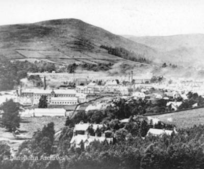
The mill buildings and chimneys can be seen in the photo below. The railway line ran into the terminus from the bottom left of the picture from a junction on the the Edinburgh-Carlisle line. The houses in the trees in the foreground belonged to business owners.
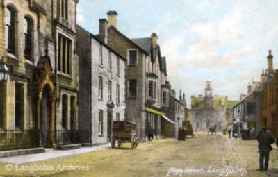
The High Street can be seen in the colorised photo below. The town hall is in the distance with its clock tower.
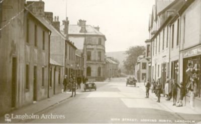
The following photo is also of the High Street, looking in the opposite direction.
Langholm Bridge (now Thomas Telford Bridge) over the River Esk was constructed in the 1770s. One of the masons was Thomas Telford (1757-1834) who grew up in the neighbouring parish of Westerkirk and went on to design numerous infrastructure projects. In later life he made significant donations to the Langholm Library and the Westerkirk Library.
